Program Placement Rate:
100%
Source 2021-22 Dunwoody Career Services Annual Report
Land Surveying
Already have a bachelor’s degree and looking to explore a new career opportunity? Dunwoody’s Land Surveying Certificate provides you with an avenue to become a licensed Land Surveyor in the State of Minnesota.
32.7
Job Inquiries Per Dunwoody Graduate
Source 2019-20 Dunwoody Career Services Annual Report
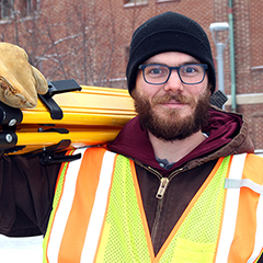
Dunwoody Land Surveying
Dunwoody’s Land Surveying certificate was created for those who already have a bachelor’s degree and are looking to become professional, licensed land surveyors.
This program also provides an accelerated option for those without a bachelor’s degree to become surveying technicians and offers a path for them to become a licensed surveyor with the completion of a bachelor’s degree along with meeting the other requirements for licensure.
Students gain field experience using industry-standard technology and receive instruction from industry experts.
Opportunities to participate in national competitions will help build your resume, and hands-on, outdoor projects and labs get you out of the classroom and into the environment you’ll be working in.
Software you will use include a suite of computer-aided drafting programs (CAD) including Autodesk Civil 3D and Recap. Upon graduation, you’ll be eligible to take the Fundamentals of Land Surveying (FLS) exam—the first step in becoming a licensed land surveyor.
The certificate consists of 22 technical credits, which can be completed in just two semesters.
Credits earned in the Land Surveying certificate directly transfer into Dunwoody’s Surveying & Civil Engineering Technology associate’s degree.
” I had recently received my GIS degree but wasn’t satisfied with where it was taking me, so I enrolled in Dunwoody’s surveying program. The hands-on learning was great, and when I started my summer internship and current job I was able to jump right in. I had the interview for my current position before I had even finished classes. “
Kyle Knutson
Dunwoody Land Surveying Certificate Alum
Class topics include:
- GPS and geodetic surveying
- 2D and 3D drafting
- Boundary control
- Land-use planning
Degree Requirements
To view program requirements, including required courses, electives, course descriptions, and credit hours, visit:
Student Organizations
Opportunities to get involved outside of the classroom include:
- National Electrical Contractors Association Student Chapter (NECA)
- SkillsUSA
Facilities
Surveying Lab
Uses the Dunwoody campus and its environs as a lab for learning the tools and techniques used in surveying both outdoor and indoor spaces. SURVEYING EQUIPMENT:
- Sokkia Automatic & Digital Levels
- Trimble & Leica Total Stations
- Trimble & Topcon GNSS (GPS) Receivers & Data Collectors
- Phantom 3 & Phantom 4 Drones (used for photogrammetry & RTK surveying)
- Faro Laser Scanner
- Laptop Computers loaded with Industry Software